Small Changes Could Mean Big Gains for Ocean Carbon Sink Estimates
- Author(s):
- Lucie A. C. M. Knor (GEOMAR), Dorothee C. E. Bakker (UEA), Louise Delaigue (LOV), Amanda R. Fay (LDEO), Daniel J. Ford (UEXE), Siyabulela Hamnca (CSIR), Thea H. Heimdal (LDEO), Galen A. McKinley (LDEO), Peter Landschützer (VLIZ), Siv K. Lauvset (NORCE), Kevin O’Brien (OceanOPS), Alizée Roobaert (VLIZ), Richard Sanders (NORCE), Adrienne J. Sutton (NOAA PMEL), Jamie D. Shutler (UEXE), Tobias Steinhoff (GEOMAR), Maciej Telszewski (IOCCP), Bronte Tilbrook (CSIRO)
The ocean absorbs around 30% of the carbon dioxide (CO₂) released by human activities. To monitor this vast carbon sink, scientists rely on satellite data, reanalysis datasets and a key network of research vessels, commercial ships, moorings and autonomous platforms that collect in-situ surface ocean CO₂ measurements across the world's ocean. Yet, large parts of the ocean remain poorly observed, particularly in the southern hemisphere. In fact, these in-situ observations cover only 2.3% of monthly ocean grid cells measuring 1° latitude by 1° longitude, leaving large areas and times without direct measurements.
In 2026, an international group of researchers conducted a series of network design experiments to assess whether expanding the existing in-situ component of the observing system could improve estimates of the global ocean carbon uptake. Their model-based results suggest that targeted additions, particularly in poorly sampled regions and seasons, could improve estimates of the global ocean carbon sink by 33%.
An uneven observing network
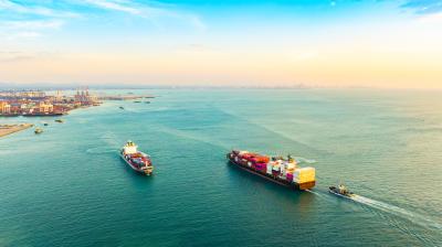
The main workhorses of the in-situ observing network are surface ocean CO₂ measurement systems fitted to ships of opportunity, ranging from dedicated polar research icebreakers to commercial cargo vessels and ferries operating on fixed routes. Additional measurements are collected by moorings, fixed stations and uncrewed surface vehicles.
For the period 2020 – 2024, the 2025 release of the Surface Ocean CO₂ Atlas (SOCAT), a global synthesis of quality-controlled, in-situ surface ocean CO₂ measurements, contains observations from 76 ships, 46 moorings and fixed stations, and six uncrewed surface vehicles. Together, these platforms provided an average of approximately 9 000 observing days per year.
Despite this substantial effort, the network is highly irregular, strongly biased towards the northern hemisphere, and large ocean regions remain without data. The Southern Ocean during winter is particularly poorly observed.
This uneven coverage presents a challenge for estimating global ocean carbon uptake. Researchers must account for large regions and periods without direct measurements when calculating how much CO₂ the ocean absorbs.
Differences also persist between estimates of the ocean carbon sink derived from these observations and those simulated by global ocean biogeochemical models. Observation-based products used in the Global Carbon Budget generally indicate a larger ocean carbon sink than model-derived estimates. The reason for this discrepancy remains an active area of research, with one prominent hypothesis being that insufficient observational coverage, particularly in the southern hemisphere, is a significant factor.
How ocean observations inform global carbon estimates
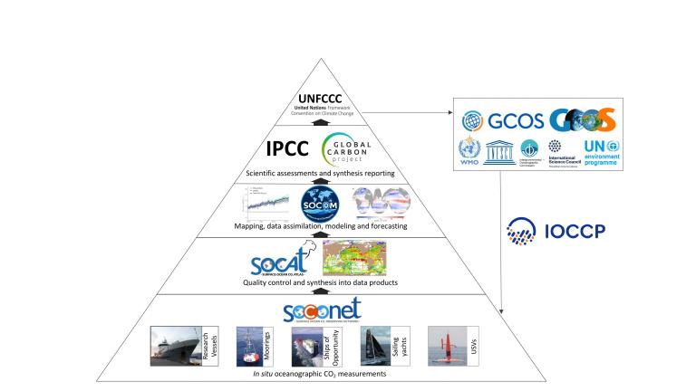
Surface ocean CO₂ observations form part of an interconnected system of measurement, data processing and scientific analysis known as the Surface Ocean Carbon Value Chain (Figure 1).
The Surface Ocean CO₂ Observing Network (SOCONET), an emerging network of the Global Ocean Observing System (GOOS), brings together high-quality in-situ measurements collected by scientists worldwide. These measurements are subsequently compiled and quality-controlled through SOCAT.
Multiple research groups combine these sparse and uneven in-situ surface ocean CO₂ observations with satellite and reanalysis products, to fill gaps in space and time and generate estimates of surface ocean CO₂ and air-sea CO₂ exchange across the global ocean. The Surface Ocean CO2 Mapping (SOCOM) programme brings together research groups developing these mapping and analysis approaches.
These estimates contribute to the annual Global Carbon Budget and assessments by the Intergovernmental Panel on Climate Change (IPCC). The International Ocean Carbon Coordination Project (IOCCP), which also serves as the GOOS Biogeochemistry Panel, plays an important role in connecting the different elements of this system.
The Surface Ocean Carbon Value Chain is also expected to provide an initial estimate of ocean carbon uptake, known as a prior, for the atmospheric inversion component of the WMO Global Greenhouse Gas Watch (G3W). Better estimates of the ocean carbon sink help constrain estimates of the land carbon sink and improve understanding of seasonal variations in atmospheric CO₂, particularly in the southern hemisphere.
Testing improvements to the observing network
To evaluate how additional observations might improve ocean carbon sink estimates, an international consortium of researchers conducted network design experiments focused on surface ocean CO₂ and air – sea CO2 fluxes in 2026.
One way to test the accuracy of the reconstructed ocean CO₂ estimates is to withhold some observations and compare them with the reconstructed results. However, the existing observing network is too sparse for this approach to provide a reliable assessment. Instead, the researchers used model-based experiments, known as testbed studies.
They sampled surface ocean CO₂ fields from three global ocean biogeochemical models at locations corresponding to the existing observing network and potential additional measurements. Using six approaches that contribute to the ocean carbon sink estimates in the Global Carbon Budget, they reconstructed ocean CO₂ conditions from these samples. By comparing the reconstructions with the original model fields, they could assess how different observing network configurations affected the accuracy of estimates of surface ocean CO₂ and air-sea CO₂ exchange.
The experiments focused on regions where previous studies suggested that increased observing effort would be useful, particularly the Southern Ocean and the subtropical southern hemisphere. They also considered locations where measurements had previously been collected but had since been discontinued.
Using existing ocean observing databases and vessel information, the researchers identified several potential sources of additional measurements: previously active ships that had stopped contributing CO₂ data, research and commercial vessels operating in the Southern Ocean, and voluntary observing ships already collecting other oceanographic measurements.
They also considered the uncrewed surface vehicle array associated with the Constraining Ocean Carbon with Optimized Observing (COCO2) project. The project began deploying autonomous sailing vehicles in the Southern Ocean in September 2026. The vehicles will collect high-quality CO₂ measurements during repeated circumnavigations of Antarctica over the 2026 – 2030 period, particularly during winter, thus helping to address observational gaps. The array is expected to contribute approximately 600 observing days per year.
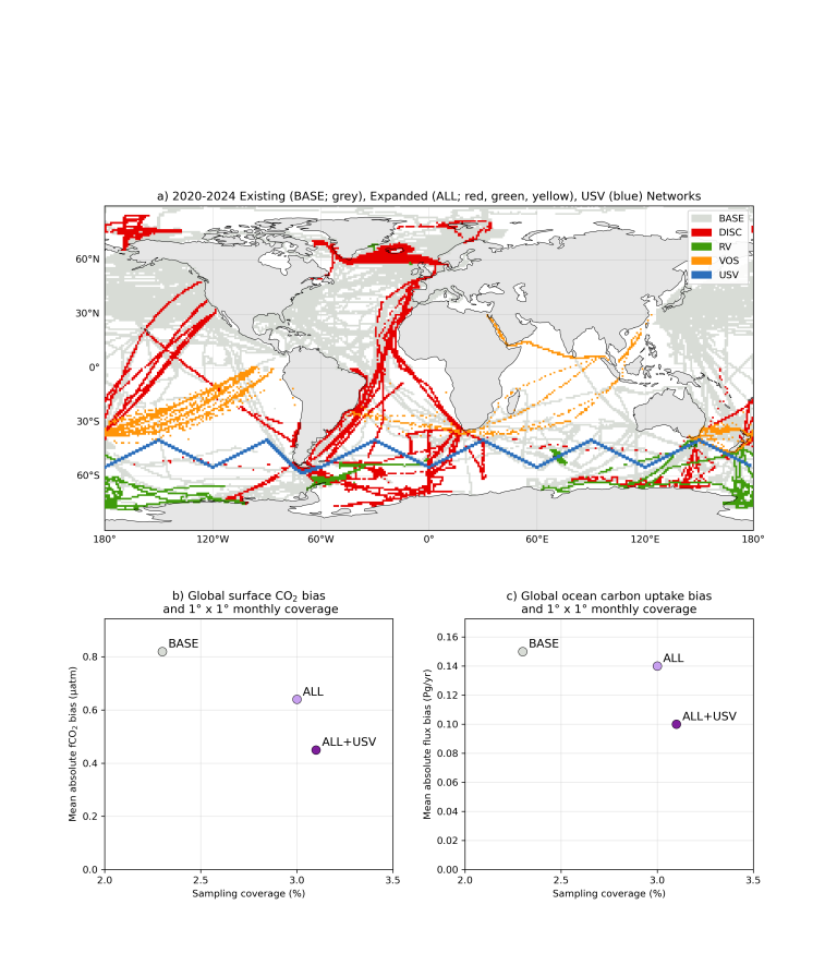
The researchers compared three network configurations: the existing observing network available via SOCAT, an expanded network incorporating additional ship-based observations, and an expanded network that also included the autonomous vehicles (Figure 3). Six reconstruction approaches were used to evaluate the expanded ship-based network, while four were used for the scenario including autonomous vehicles.
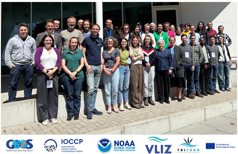
The results of the experiments were discussed at the Ocean Carbon Observing Design Workshop, held at the Flanders Marine Institute (VLIZ) in Ostend, Belgium, on 10 – 11 June 2026.
Where additional observations make the greatest difference
The experiments found that relatively modest additions to the observing network could substantially improve the accuracy of reconstructed ocean carbon uptake.
Adding the identified ship-based observations increased monthly coverage of 1° latitude by 1° longitude ocean grid cells from 2.3% to 3.0%. Further including the autonomous vehicles raised coverage further to 3.1%.
Adding ship-based observations improved reconstruction skill, with further gains when autonomous vehicles were included. Together, these additions reduced the bias in the reconstructed global annual ocean carbon sink estimate by 33% compared with the existing observing network.
Consistent with past research, these experiments demonstrate that new in-situ CO₂ measurements in regions and seasons most poorly represented in the existing network are particularly valuable for improving global, regional and seasonal reconstruction accuracy.
This was especially evident for the autonomous vehicles operating in the Southern Ocean during winter. Although they added only 0.1 percentage points to global monthly coverage, they produced a substantial further improvement in the reconstructed ocean carbon sink.
These results reflect the performance of the observing networks within the framework of observing system simulation experiments using numerical simulations as a testbed platform. Thus, the results are the best-known approach to estimate what the total uncertainty of real world ocean carbon sink would be, but do not guarantee that these improvements would be achieved.
Opportunities to strengthen ocean carbon monitoring
The network design experiments suggest that a modest enhancement of the current in-situ observing system could significantly improve our ability to constrain ocean carbon uptake.
Based on these findings, the researchers identified three practical ways to expand observations in poorly sampled regions and seasons:
- Reactivate recently discontinued or paused SOCONET observing routes, potentially providing up to 400 additional observing days per year
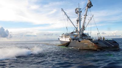
- Equip additional research vessels, cruise liners and fishing vessels operating in the Southern Ocean during summer with high-quality CO₂ measurement systems, providing approximately 400 observing days per year
- Install high-quality CO₂ measurement systems on voluntary observing ships operating across the subtropical southern hemisphere, adding about 160 observing days per year
Together, these additions would involve 33 platforms and increase annual sampling days by an estimated 12%, or 19% when the planned autonomous vehicle array is included. Because the expansion targets poorly observed regions and seasons, the experiments suggest that this relatively modest increase in observing effort could increase monthly, 1° latitude by 1° longitude coverage by approximately 35% and reduce the modelled bias in global ocean carbon sink estimates by 33%.
Maintaining the existing observing network is equally important. The current ship-based network and the planned COCO2 autonomous vehicle array are expected to provide approximately 9 600 observing days per year until 2030. Sustaining SOCONET is a persistent challenge for scientists seeking funding from their national science agencies and continuing the autonomous measurements beyond the COCO2 project will also require continued international coordination.
Some of these platforms could also collect high-quality atmospheric CO₂ measurements, offering opportunities to compare and validate observations from different systems and contribute to both oceanic and atmospheric monitoring. Improved ocean carbon sink estimates would also support G3W, helping to constrain estimates of land carbon uptake and seasonal variations in atmospheric CO₂.
However, the density of measurements required to achieve a particular uncertainty in local, regional or global estimates remains unclear and is the subject of ongoing research. Further network design studies could help determine how different observing strategies might improve estimates of the ocean carbon sink across space and timescales. Additionally, the workshop identified two other critical observation data needs, satellite and reanalysis data, which were not examined in detail. Evaluating these needs and ensuring continued access to these data remain essential for ocean carbon assessments.
Disclaimer
The scientific results and conclusions, as well as any views or opinions expressed herein, are those of the authors and do not necessarily reflect those of the US Department of Commerce, the National Oceanic and Atmospheric Administration (NOAA), NOAA Research, the European Union nor the European Research Executive Agency (REA). Neither the European Union nor the granting authority can be held responsible for them.