From Pixels to Flow: How Images Are Revolutionizing River Discharge Measurement

Reliable hydrological data – essential for early warnings for water-related hazards and for managing water resources – is lacking in many regions. Hydrometric systems must become more efficient to fill the data gap, yet National Meteorological and Hydrological Services (NMHSs), especially in developing countries, continue to use risky, labour-intensive, manual methods though non-contact measurements techniques – like surface velocimetry – enable safer, remote, cost-effective river monitoring. Adoption of new methods by NMHSs is hindered by a lack of collaboration with innovators, insufficient trust in new techniques and challenges in turning research into operational tools. The Global Hydrometry Support Facility (WMO HydroHub) is tackling these challenges through its Innovation Calls.
Between 2019 and 2025, four HydroHub Innovation Calls supported six projects in (by order of implementation) South Asia, Central America, East Africa, the Pacific and Latin America and the Caribbean. Three of the projects tested surface velocimetry as alternative ways to monitor rivers.
The project “Open-source non-contact river flow observations with cameras for Africa” led by the Trans-African Hydro-Meteorological Observatory (TAHMO) introduced an exciting solution: OpenRiverCam. This web-based tool makes the set up for river monitoring easier, by using just a staff gauge, a camera (or smartphone) and simple, affordable survey equipment. With no software costs, it offers an affordable way to track river flow and maintain rating curves.
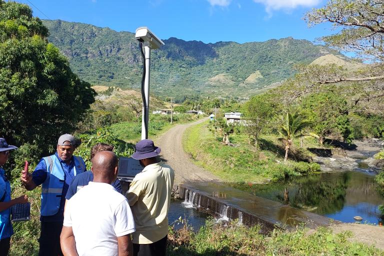
The Hydro-Space-Time Image Velocimetry (Hydro-STIV) (Fiji, 2023) project, led by the National Institute of Water and Atmospheric Research (NIWA) of New Zealand, introduced camera stations for flood flow measurement in Fiji. Two such stations, designed to work without Ground Control Points, were installed in the headwaters of the RakiRaki catchment (Vatukacevaceva and Narara). Both can be activated on a timelapse, based on water level or manually by residents (citizen science). A workshop trained staff from Fiji Meteorological Service (FMS), the Pacific Community (SPC), and Water Authority Fiji in field data collection, station setup and data processing.
The RIVER-LAC (Latin America and Caribbean, 2025) project was implemented by the National University of Córdoba (UNC) through the Hydraulics Linkage Center of the Faculty of Exact, Physical, and Natural Sciences (FCEFyN) of Argentina, in partnership with National Water Institute of Argentina (INA) and ORUS. Using Large-Scale Particle Image Velocimetry (LSPIV), the project team developed RIVeR (Rectification of Image Velocity Results), an open-source, user-friendly software for processing surface flow data, along with clear step-by-step guidelines. The approach was tested in real conditions in Buenos Aires and Córdoba and compared with traditional methods. The results were shared through a RIVeR-LAC webinar that drew some 250 participants from over 30 countries in the LAC region.
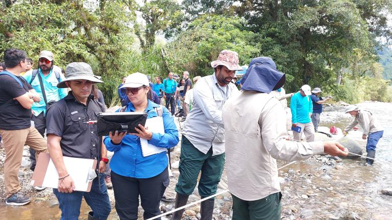
In addition, WMO HydroHub and the Instituto Costarricense de Electricidad (ICE) hosted a hands-on workshop on river flow data in Costa Rica in May that attracted 35 LAC participants. The training focused on the use of drones and fixed cameras to collect and process river flow data – building practical skills for alternative ways of water monitoring. The event encouraged inclusive participation in WMO capacity building activities - almost half of the WMO-funded trainees were young female professionals.

Building on the momentum of the Innovation Calls on surface velocimetry, WMO HydroHub brought together project leads and Think Tank members in late May for a strategic discussion on the way forward. Key priorities came out: build a shared repository for method comparison and standardization work, expand regional training, and showcase real-world use cases that demonstrate the reliability and accuracy of surface velocimetry to build institutional trust. These steps will lay the groundwork for turning innovation into everyday practice and making it part of WMO standards and guidelines – bringing smarter, more resilient water monitoring and closing the data gap.
For those wishing to learn more, the first issue of the WMO HydroHub Innovation Snapshot: Introduction to non-contact technologies for hydrometry (2023) provides in depth analysis of various methods, their advantages and limitations.
The HydroHub is supported by the Swiss Agency for Development and Cooperation (SDC) and the Inter-American Development Bank (IDB). For more details on the HydroHub project, visit our WMO HydroHub website or contact us at Hydrohub wmo [dot] int (Hydrohub[at]wmo[dot]int).


