Earthquake off Russian coast prompts tsunami warnings and mass evacuations in Pacific
WMO is closely monitoring developments. WMO coordinates closely with UNESCO’s Intergovernmental Oceanographic Commission, which relies on National Meteorological and Hydrological Services for essential data collection, dissemination and international communications arrangements through WMO’s Information System and its Global Telecommunication System.
WMO works closely with the UN Office of Disaster Risk Reduction and other partners to ensure that system-wide tsunami preparedness feeds into the Early Warnings for All initiative.
“Tsunamis strike with little warning and immense force. Multi-hazard early warning systems—backed by risk knowledge, rapid forecasts, and clear communication—are not optional; they are life-saving,” said WMO Secretary-General Celeste Saulo. “We have made great strides in the past 20 years, but we can do even more. The latest earthquake and tsunami threat once again highlights the need for regional and international collaboration to prevent a natural hazard becoming a human tragedy.”
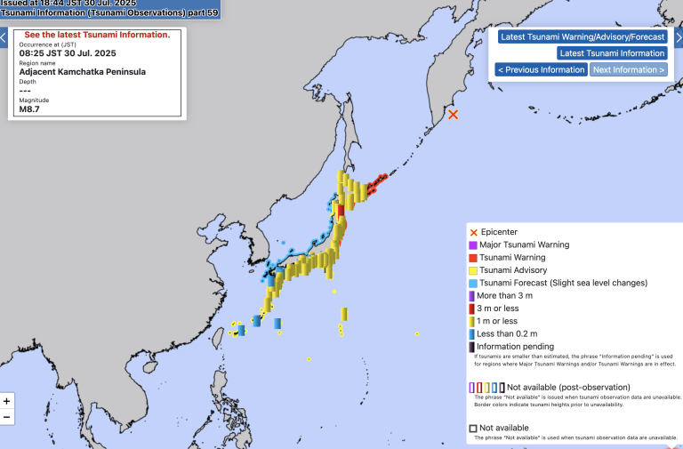
The earthquake was exceptionally powerful at 8.8 magnitude. It hit off the east coast of Russia’s Kamchatka Peninsula on 29 July at 23.24 GMT. It triggered tsunami warnings across the Pacific – including from the Japan Meteorological Agency and the US National Oceanic and Atmospheric Administration (NOAA) Tsunami Warning Center.
Millions of people were ordered to evacuate in the Russian Federation, Japan and parts of the USA (including Hawaii).
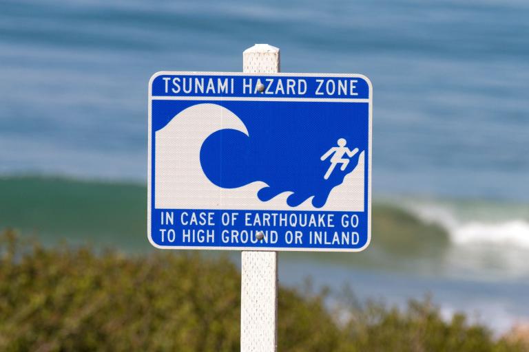
Most tsunami are generated by an undersea earthquake. Other less frequent causes of tsunami are undersea or coastal volcanoes and/or landslides. As these ocean depth waves, travelling at the speed of a jetliner, make their way towards land, they can build to enormous heights with immense energy, posing a dangerous threat to coastal communities.
They require immediate hydrometeorological warnings and coordinated emergency response.
Two powerful examples illustrate both the strengths and challenges of integrated early warning systems:
In 2011, a magnitude 9.0 earthquake struck off the coast of Japan, triggering a devastating tsunami that claimed over 18,000 lives and caused the Fukushima nuclear disaster. The Japan Meteorological Agency (JMA) issued extensive warnings, and global tsunami monitoring systems were activated within minutes, showcasing the value of robust early warning infrastructure.
In contrast, the 2018 Sulawesi earthquake in Indonesia, measuring magnitude 7.5, triggered a localized tsunami in Palu Bay, worsened by submarine landslides. Despite existing systems, the event exposed serious gaps in rapid detection and communication, highlighting the urgent need to strengthen end-to-end early warning systems, particularly for near-field events.
The international and regional early warning network has been greatly strengthened since the Indian Ocean tsunami of 2004 killed around 230,000 people in one of the deadliest disasters in recent history.
Today the UNESCO/IOC retains responsibility for coordinating tsunami warnings across all oceans and seas through regional Intergovernmental Coordination Groups (ICGs). The WMO Secretariat and its Members work closely with the UNESCO/IOC on many aspects of this work.
WMO and UNESCO/IOC work together closely through the IOC Working Group on Tsunami and Other sea level related Warning and mitigation System (TOWS-WG) to improve global tsunami readiness and to strengthen coordination between Tsunami Warning Centres and National Meteorological and Hydrological Services.
Globally, over 35% of all National Tsunami Warning Centres (NTWCs), are operated by NMHSs, which is the majority proportion of all agency categories. Furthermore, some regions have up to 80% of their NMHSs involved in the early warning process. WMO is continually working to build NMHS capacities and capabilities to ensure they can provide warnings that are timely, accessible and easily understood.
The ongoing Ocean Decade has a Tsunami Programme to strengthen collaboration on observing networks, data sharing protocols, and the use of emerging technologies, as well to contribute to capacity development, impact-based forecasting methodologies, and regional cooperation.


